CaRINA Dataset: Benchmark for Road Detection in Challenging Urban Scenarios
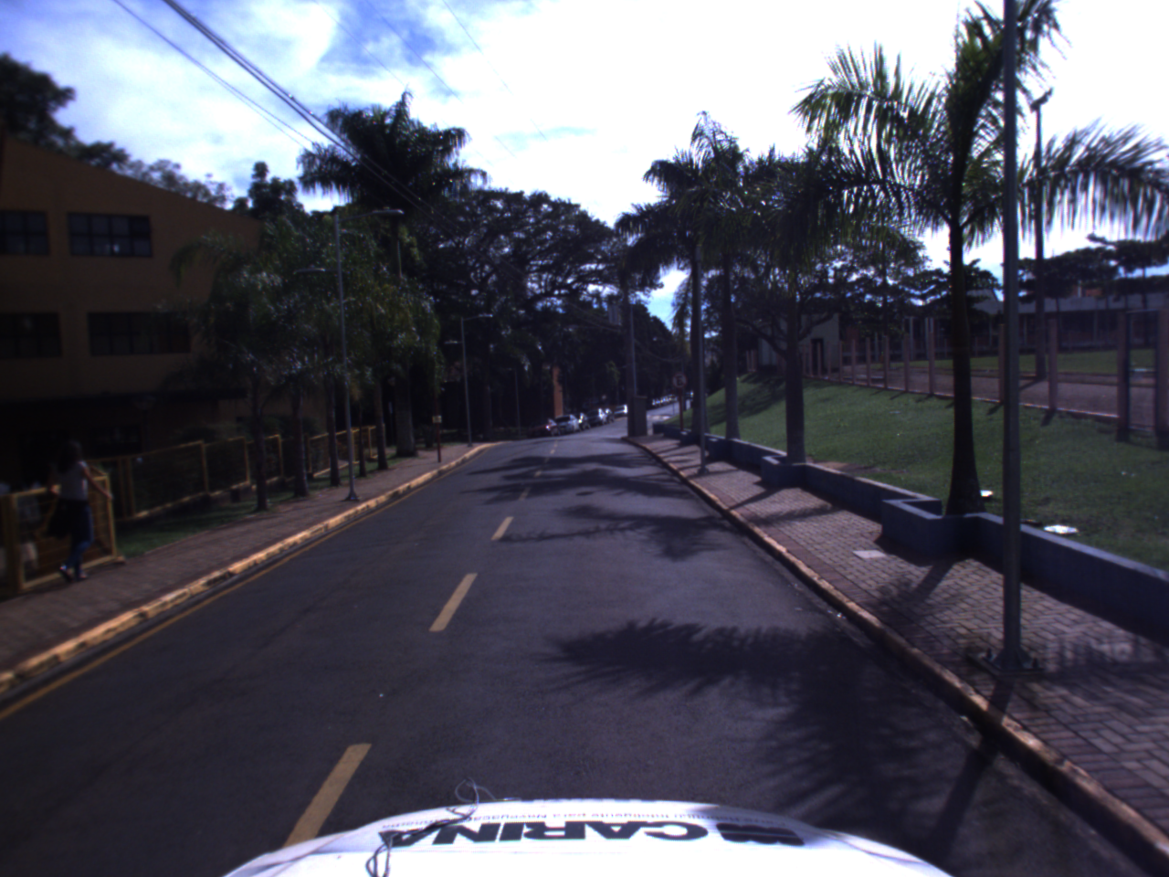
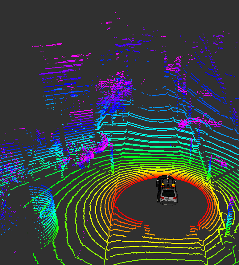
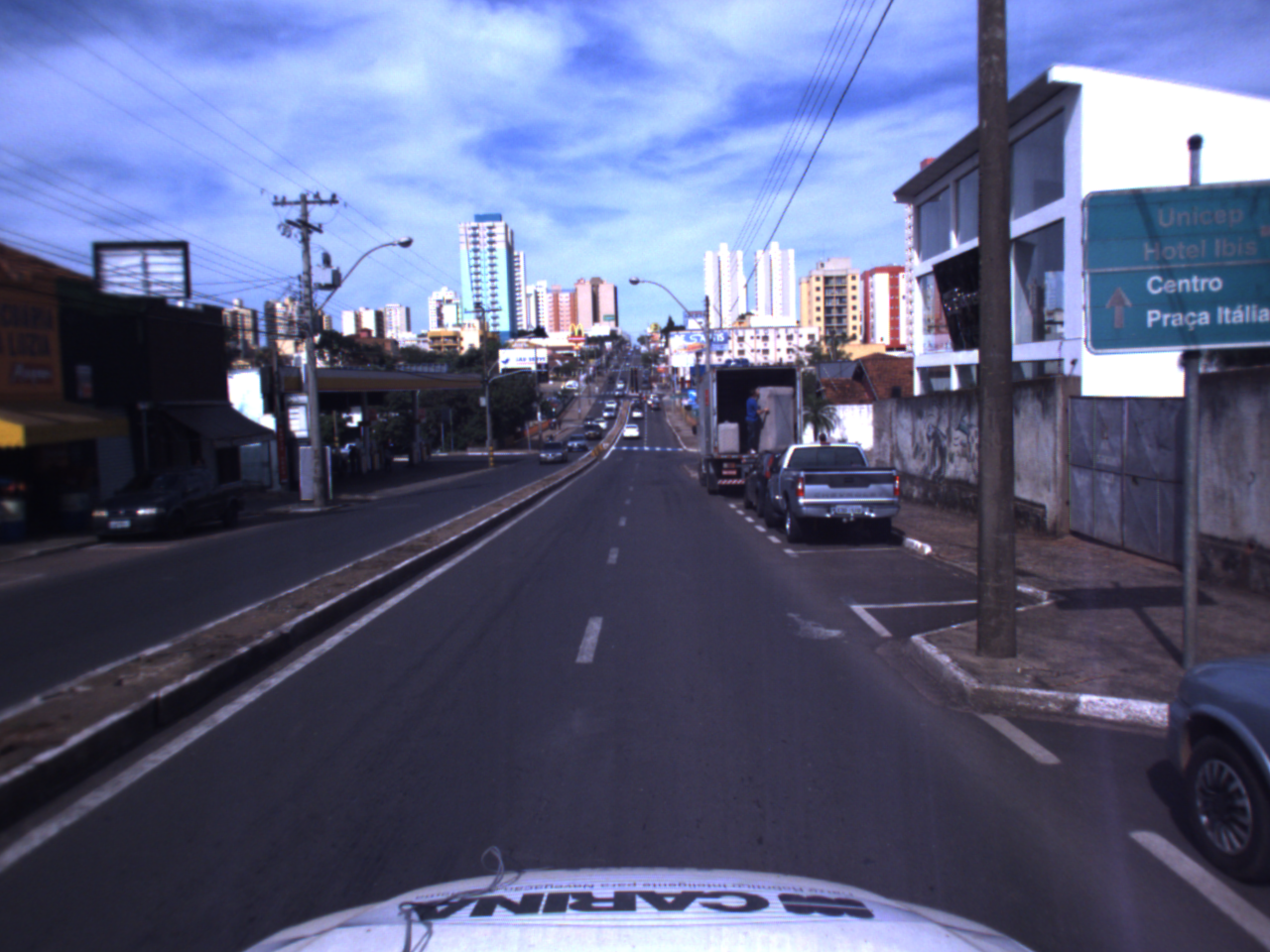
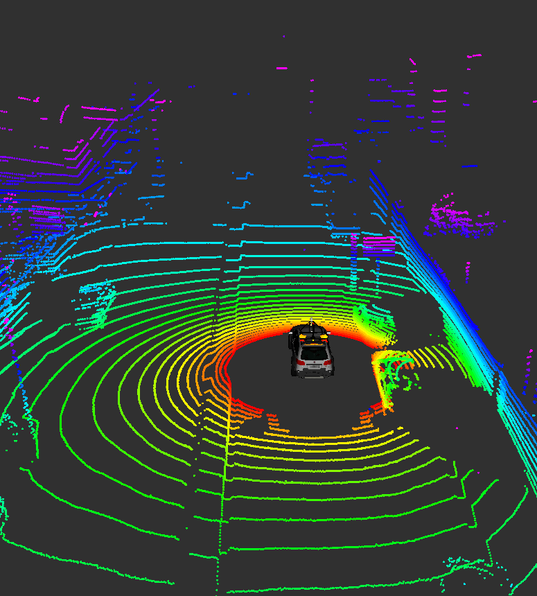
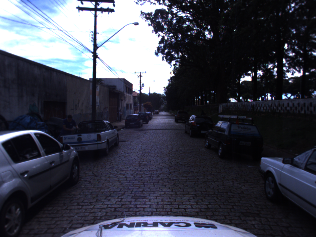
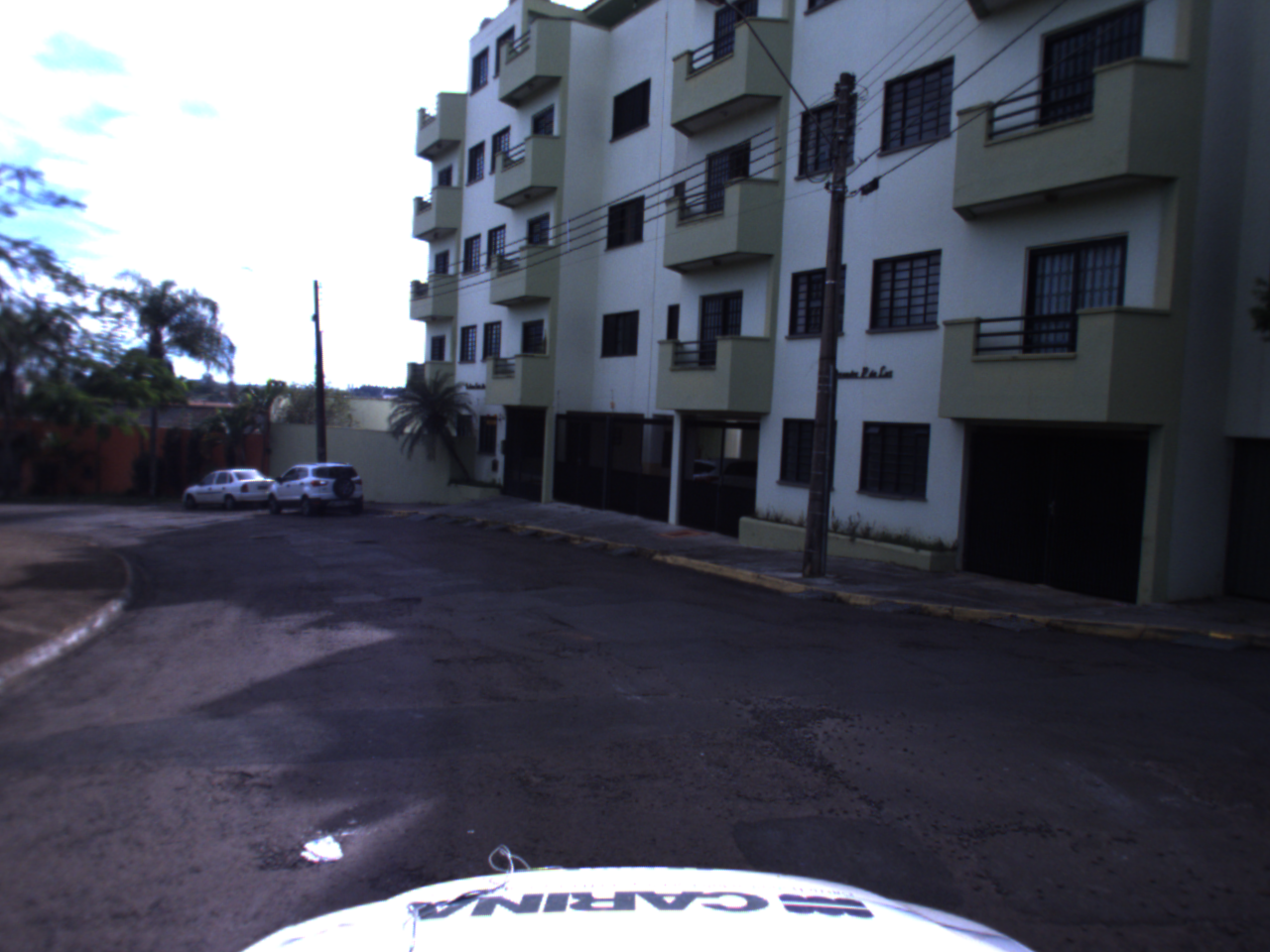
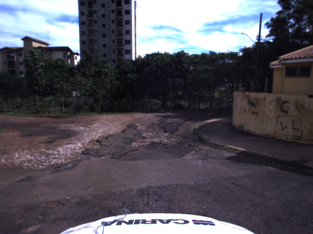
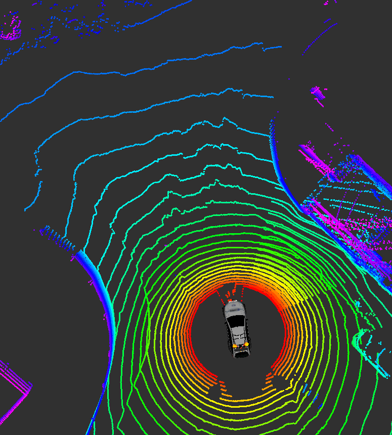
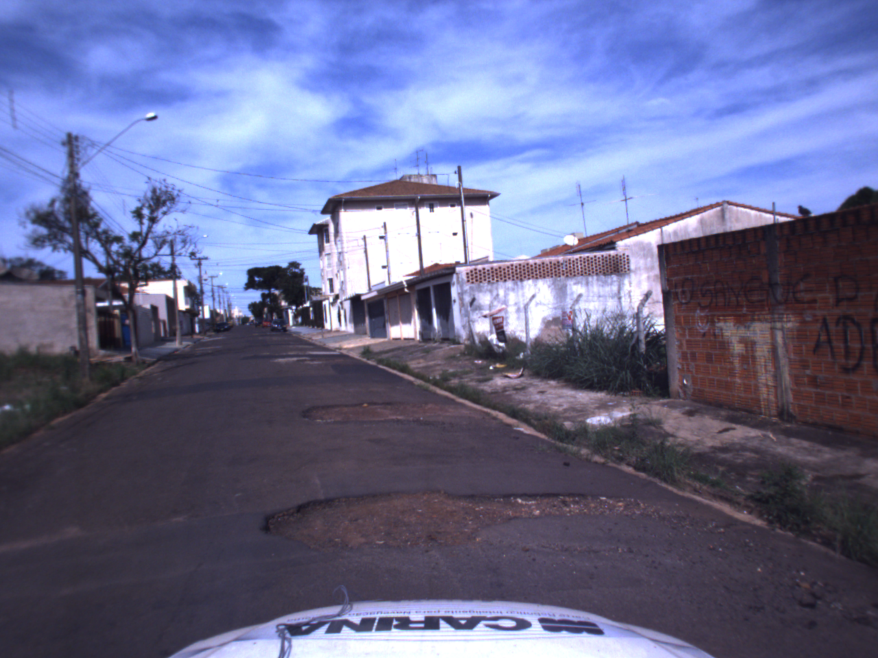
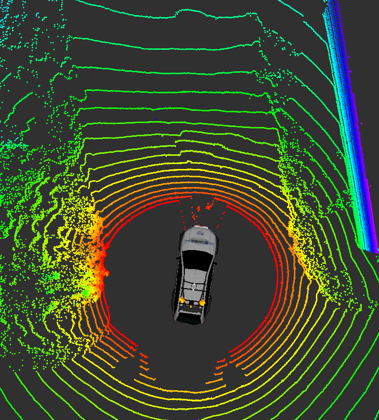
Detection of the road surface is a key capability for both path planning and object detection for Autonomous Vehicles. Current road datasets and benchmarks only depict European and North American scenarios, while emerging countries have higher projected consumer acceptance of AV and DAS technologies. This page presents selected Brazilian urban scenarios datasets and road detection benchmark s consisting of annotate RADAR, LIDAR and camera data. The main focus of this work is to provide challenging scenarios for road detection algorithms evaluation.

Collected data coverage (blue) from a neighborhood surrounding the university campus of São Carlos; Select segments (red); and regions without RTK correction on GPS signal (yellow).
License
All datasets on this page are copyright by us and published under the Creative Commons Attribution-NonCommercial-ShareAlike 3.0 License. You must give appropriate credit, provide a link to the license, and indicate if changes were made. You may do so in any reasonable manner, but not in any way that suggests the licensor endorses you or your use. You may not use the material for commercial purposes. If you remix, transform, or build upon the material, you must distribute your contributions under the same license as the original.
Citation
@INPROCEEDINGS{7795529,
author={P. Y. Shinzato and T. C. dos Santos and L. A. Rosero and
D. A. Ridel and C. M. Massera and F. Alencar and M. P. Batista and A. Y. Hata and F. S. Osório and D. F. Wolf},
  booktitle={2016 IEEE 19th International Conference on Intelligent Transportation
  Systems (ITSC)},
  title={CaRINA dataset: An emerging-country urban scenario benchmark for road
detection systems},
  year={2016},
  doi={10.1109/ITSC.2016.7795529}
}
Easy
Download:
- Wide-stereo color camera left (file=easy_stereo_wide_left.zip)
- Wide-stereo color camera right (file=easy_stereo_narrow_right.zip)
- Short-stereo color camera left (file=easy_stereo_narrow_left.zip)
- Short-stereo color camera right (file=easy_stereo_wide_right.zip )
- Velodyne HDL-32E (file=easy_pcd.zip)
- Delphi Radar (file=easy_radar.zip)
- Septentrio GPS+RTK (file=easy_gps.zip)
- Dev-kit
Medium
Download:
- Wide-stereo color camera left (file=medium_stereo_wide_left.zip)
- Wide-stereo color camera right (file=medium_stereo_narrow_right.zip)
- Short-stereo color camera left (file=medium_stereo_narrow_left.zip)
- Short-stereo color camera right (file=medium_stereo_wide_right.zip)
- Velodyne HDL-32E (file=medium_pcd.zip)
- Delphi Radar (file=medium_radar.zip)
- Septentrio GPS+RTK (file=medium_gps.zip)
- Dev-kit
Difficult
Download:
- Wide-stereo color camera left (file=hard_stereo_wide_left.zip )
- Wide-stereo color camera right (file=hard_stereo_narrow_right.zip)
- Short-stereo color camera left (file=hard_stereo_narrow_left.zip)
- Short-stereo color camera right (file=hard_stereo_wide_right.zip )
- Velodyne HDL-32E (file=hard_pcd.zip)
- Delphi Radar (file=hard_radar.zip)
- Septentrio GPS+RTK (file=hard_gps.zip)
- Dev-kit